Drone Services
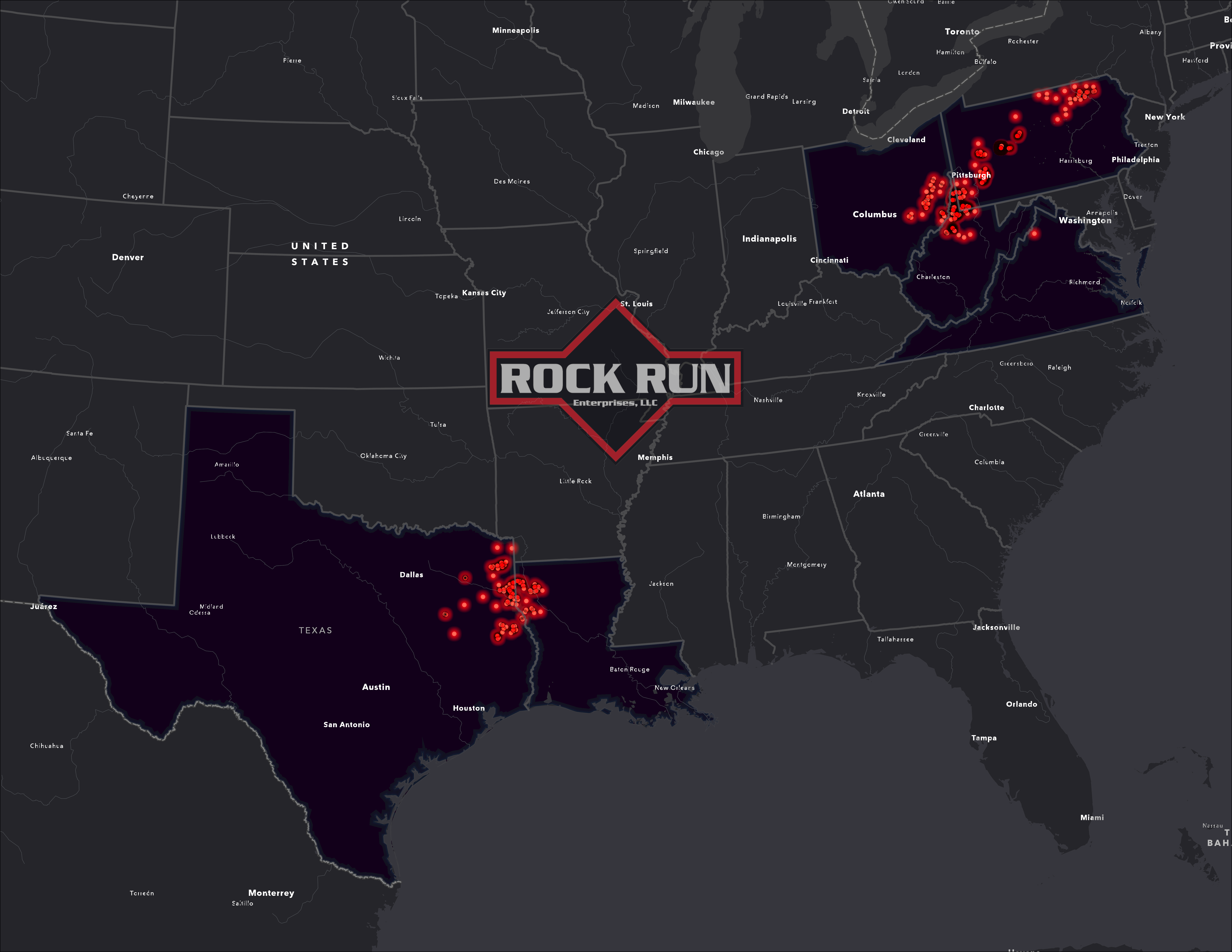
Rock Run is on the cutting edge of drone and aerial UAS services. Rock Run utilizes thermal, lidar, multi-spectral, and high resolution imagery drones that cater to many industries. We have flown thousands of flight missions all across the United States. Rock Run serves many different clients in natural resources, real estate, surveying, and agriculture.
Choosing a licensed pilot for private and commercial projects ensures clients receive professional service in compliance with all local and federal regulations. Rock Run takes advantage of the FAA LAANC program for minimal downtime.
Using the latest technologies, Rock Run has the ability to photograph, film, and map any project you present. We are fully insured and process all of our data in house to ensure quality control and privacy.
Our drone services consist of:
- Utility Line and Right of Way Inspections – Inspect sensitive utility infrastructure before, during, and after construction. Check status of encroachments and vegetation.
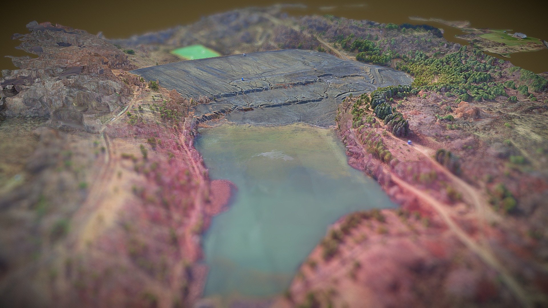
- 3D Modeling – We process our imagery in-house creating a high resolution 3D model for analysis, planning, or promotional purposes. Other products include 3D point clouds.
- 4K Ultra HD Video – High end cameras and professional post production software to provides broadcast quality video. Deliverable file types and formats of your choosing ie. hard copy, YouTube, hosted, etc.
- As Built Survey – We can fly your job site pre-construction and post construction. We’ll provide as-built survey files in various CAD file formats such as DWG, DXF, FBX, LAS, OBJ. Coupled with our GIS mapping capabilities, we can provide topographic elevation contours in any interval you need.
- Marketing Video and Photo – Realtors and real estate brokers can integrate landscape photos and video for your marketing campaign.
- Agricultural Monitoring – Multi-spectral and thermal infrared imagery and mapping capabilities help agriculture industry to better manage fields. Image analysis using NDVI can help spot areas in need of more irrigation or nutrients. High resolution multi-spectral photos can spot trouble areas invaded by pests. Mapping your acreage watershed can help improve planting layouts and yields.
- Golf Courses – Golf course operators have many options to use drone and GIS technology. Topographic and vegetation mapping can help grounds crews effectively manage fertilizer and watering application. Show off the golf course with ultra clear presentation quality photos. We can print up to 42″ wide for display in your facility. Let us map your course for tournaments and outings or other special occasions.
Nationwide coverage
Rock Run can travel to meet your specific needs. Call us today to book your flight!
