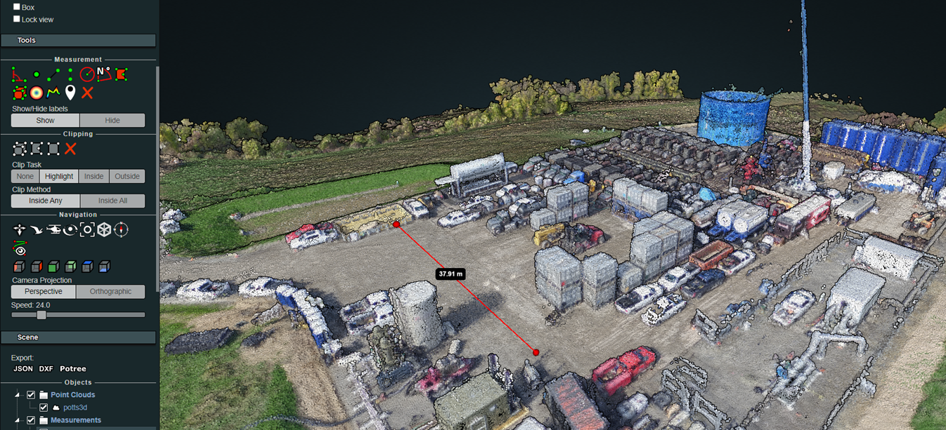
Embedded 3D Point Cloud Viewer

We’ve been continuously upgrading our capabilities and providing higher value for our services. Rock Run has just added a built-in 3D point cloud viewer embedded in our website to compliment our UAS – aerial drone imagery and laser scanner services.
While Rock Run Enterprises has been able to host 3D models on the web for a while, there hasn’t been a quick and easy way to view the point clouds.
Aerial image photogrammetry and laser scanners both create point clouds and offer the user greater accuracy in measuring dimension and scale.

The main function of a laser scanner is to measure objects and places to a high degree of accuracy, up to 1/4″ in most cases. The end result is a 3D point cloud. Point clouds are also a byproduct of generating the high-resolution 3D models from aerial drone imagery. Point cloud files contain millions of georeferenced scaled dots within a 3-dimensional space used to build the model.

To offer clients a quick and easy way to visualize their projects without the need for specialized software and computer hardware, we’ve added the option to view these files in a low impact way via their web browsers.
The embedded viewer is a quick and easy reference device to be used in any browser. Users are able to measure criteria such as length, height, and elevation profile all within their browser window.
Try out our demo viewer to see how easy it is to use.


