Punxsutawney Municipal Airport – Aerial Monitoring
Recent work has been completed and is also ongoing at the Punxsutawney Municipal Airport. We have been passively tracking construction progress for historical documentation. This has provided a means to demonstrate some of the capabilities possible with aerial drone mapping and monitoring.
Check out some of these examples below.

Baseline
The Punxsutawney Municipal Airport was flown in September of 2023 prior to major construction taking place. This provides a baseline image for comparison and historical documentation.

Hangar Construction
Construction began in the Spring of 2025 on the first new hangar facility at the airport in several decades.

Major Improvements
As part of the airport’s multi-year improvement plan, additional runway apron space was built. The space provides parking spaces for multiple planes simultaneously.
The runway identification markings were also recently repainted.

Topography
Using our drone with lidar sensor, the current topographic conditions have now been documented.

Elevation Surface
Elevation surfaces are created after the lidar sensor captures the topographic features in a point cloud. This is a shaded relief map highlighting changes in elevation.

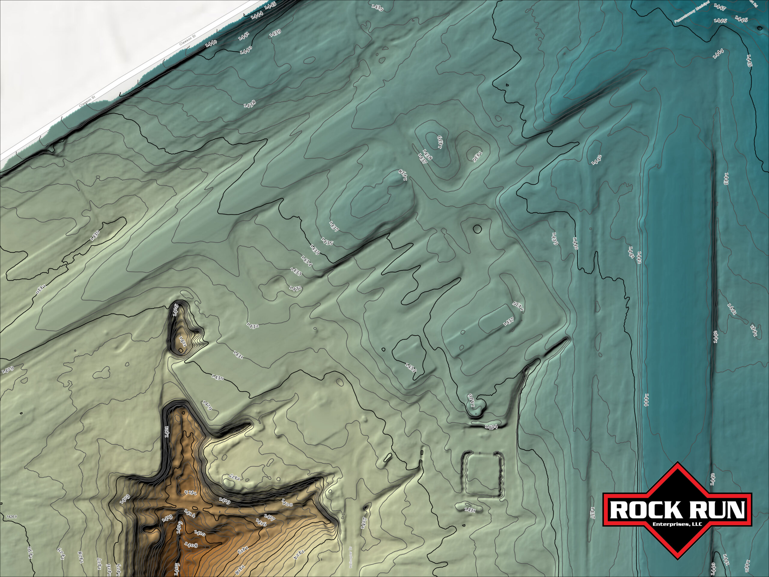
Shaded Relief
Added color to the shaded relief for enhanced visualization. Contour lines show the elevation to within a tenth of an inch.

3D Model
An interactive model has been created using the lidar point cloud.

3D Point Cloud
Interactive 3D point cloud can be used to take accurate measurements in 3 dimensions on an XYZ axis.

3D Profile
Using the 3D point cloud to measure a horizontal profile. We can check specific slope angles and elevations.

Thermal Map
Highlighting the capability of infrared thermal mapping.


